A pre-Columbian monumental landscape in the Ecuadorian Upper Amazon: first results of the application of Li- DAR in the Upano Valley.
DOI:
https://doi.org/10.5281/zenodo.7628763Keywords:
Amazonian Archaeology, airborne LiDAR, Settlement patterns, pre-Columbian Earthworks, EcuadorAbstract
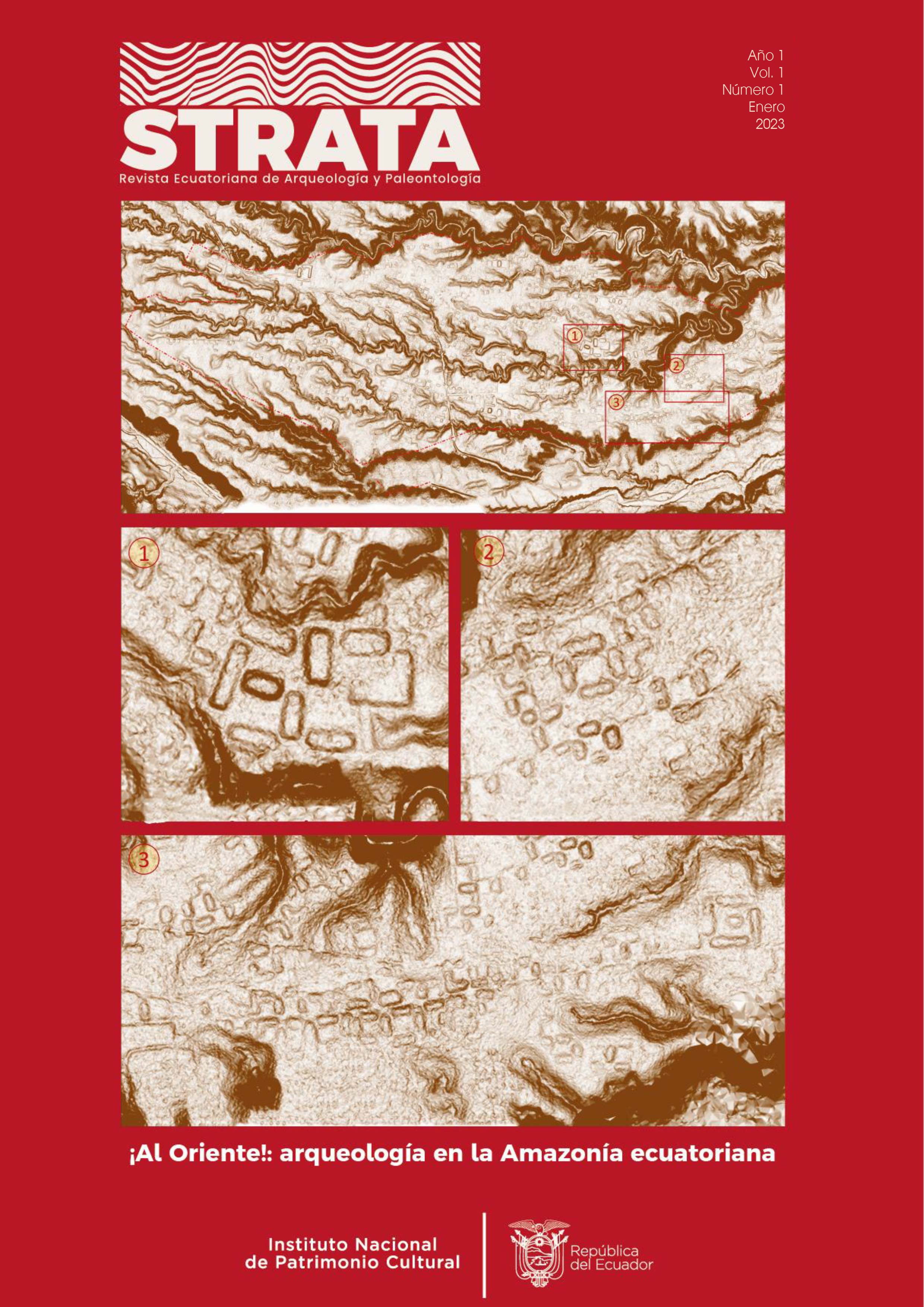
This article intends to be the informative report and synthesis of the very preliminary results of a first phase of the project General characteristics of the archaeological cultural landscape of the Upper Upano Valley, in an area of 300 km2, developed by the National Institute of Cultural Heritage in 2015. At the methodological level, the main novelty was the systematic mapping by airborne laser scanner (Light Detection and Ranging or LiDAR) for archaeological purposes in a sector of the Ecuadorian Upper Amazon, already known for pre-Hispanic artificial mounds (400 BC-400 AD). A general image of this section of the Upano Valley is provided by uncovering previously unpublished mounds assemblages, networks of roads linking different sets, and an appreciable typology of platforms. The data obtained are related to similar Amazonian studies in order to account for the constructive similarities and to offer interpretative horizons of this unique pre-Columbian landscape of the Ecuadorian Amazon. Finally, future lines of action are proposed to address these data.
Downloads
Published
Versions
- 2023-04-04 (3)
- 2023-02-15 (2)
- 2023-02-13 (1)
How to Cite
Issue
Section
License
Copyright (c) 2023 Alejandra Sánchez-Polo, Rita Álvarez Litben

This work is licensed under a Creative Commons Attribution-NonCommercial-ShareAlike 4.0 International License.